![]()
![]()
![]()
![]()
![]()
Step 6: Create a uniform finite element grid
Start our F-E grid editor OrbWin on any Windows computer. Then load your .dig file of coastlines and/or political boundaries in (longitude, latitude) format, by using command File / LoadBase [within OrbWin]. Zoom the window until it shows the area you want to model, using command View / ZoomInOut [within OrbWin]. Then use command Tools / TileRegionalGrid [within OrbWin] to create a rough finite element grid of uniform triangles, by outlining the region of your study in the counter-clockwise direction with mouse clicks. You will be able to select your desired element size from the menu; you might wish to use smaller elements than in the sample graphic below:
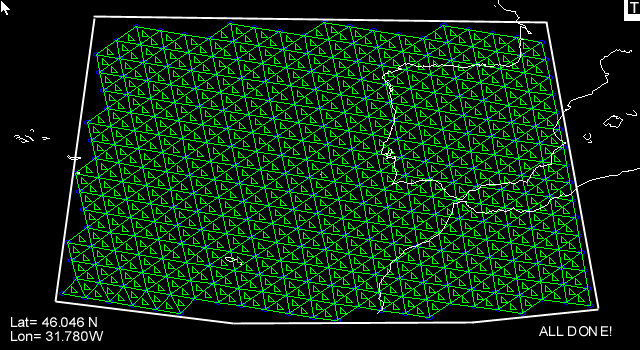
Finally, use command File / SaveGrid [within OrbWin] to output this new .feg file. You will be prompted to give it a descriptive title (which will appear in the first line of the output file). In general, it is a good idea to save your work in OrbWin fairly frequently (as an .feg file, to your hard drive) because OrbWin does NOT have any “UnDo” command!