27. Bird, P. (1991) Lateral extrusion of lower crust from under high topography, in the isostatic limit, J. Geophys. Res., 96(B6), 10,275- 10,286.
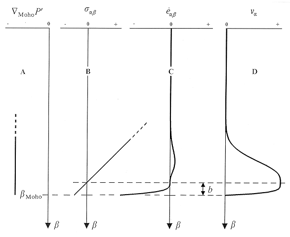
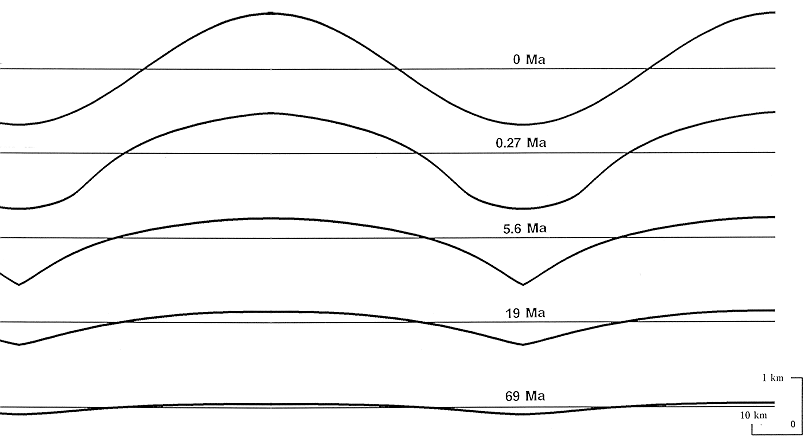
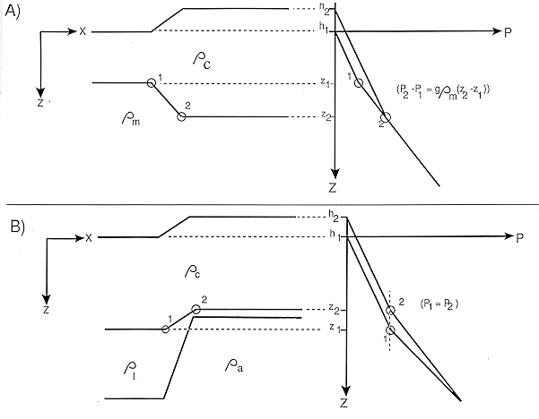
Abstract. Where there is isostasy, the rocks of the lower continental crust are subject to an effective lateral pressure gradient equal to the gradient of topographic load, whether compensation is in crustal roots or in the mantle. The result is a Poiseuille flow (planar channel flow) in the weak lower crust, which removes crust from under mountains and smooths and levels the topography. Assuming cubic power law creep, the flux of crust is proportional to the third power of the topographic gradient, to the usual Arrhenius term, to the tenth power of the absolute temperature of the lower crust, and to the negative fifth power of the geothermal gradient. The result is that any initial condition with an isolated high tends eventually toward a state where the topography is pancake shaped, with a flat central plateau and steeper flanks spreading outward. When adjacent "pancakes" merge, most of the relief is eliminated. Flow may either roughen or smooth the Moho, depending on whether there are lateral density contrasts in the mantle lithosphere or not. Although it is difficult to find analytic solutions for this evolution, it is easily simulated numerically. Using various published flow laws for plausible lower crustal rocks, lateral extrusion is shown to be insignificant under the oceans, marginally significant under shields and platforms, important under elevated plains, and dominant beneath high plateaus and/or hot, delaminated regions. In particular, the Basin and Range province of the western United States cannot maintain short-wavelength (100 km) Moho relief of more than 1 km for times greater than 10-20 m.y. at most. If the Tibetan Plateau of China has been delaminated, as recently suggested, then it may flatten even faster, reducing 100-km-wavelength topographic features to 200 m relief in no more than 0.03-0.13 m.y., and leaving only features with wavelengths over 400 km at the present. Therefore the lower crust of Tibet may resemble a hydraulic reservoir, as previously suggested. Because the flatness of the Moho is self-maintained in these regions, information on past tectonics is continually lost, and the present Moho shape cannot be used to balance cross sections for times in the past. The flatness of the Moho today is not a constraint on the mechanisms of extension or shortening in these regions, nor is it evidence for underplating by intrusions. It also follows that very intense and inhomogeneous dilational strains may have occurred locally, as in the metamorphic core complexes of the Basin and Range province.