79. Carafa, M. M. C., A. Galvani, D. Di Naccio, V. Kastelic, C. Di Lorenzo, S. Miccolis, V. Sespe, G. Pietrantonio, C. Gizzi, A. Massucci, G. Valensise, and P. Bird [2020] Partitioning the ongoing extension of the Central Apennines (Italy): Fault slip rates and bulk deformation rates from geodetic and stress data, J. Geophys. Res., 125, e2019JB018956, https://doi.org/10.1029/2019JB018956 , 23 pages.
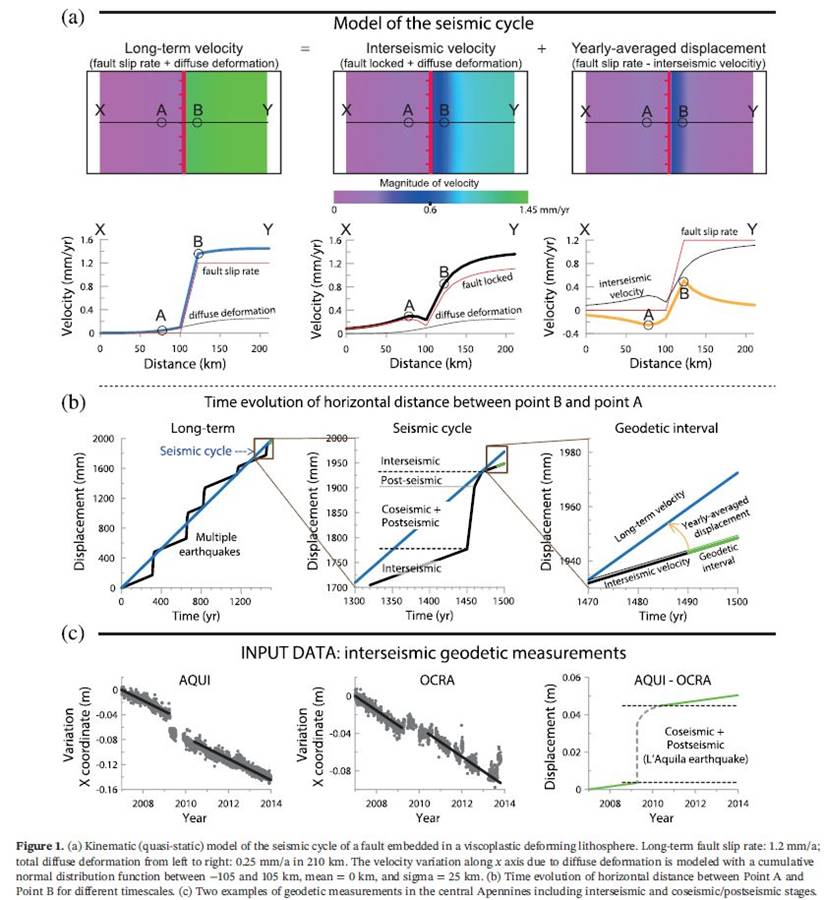
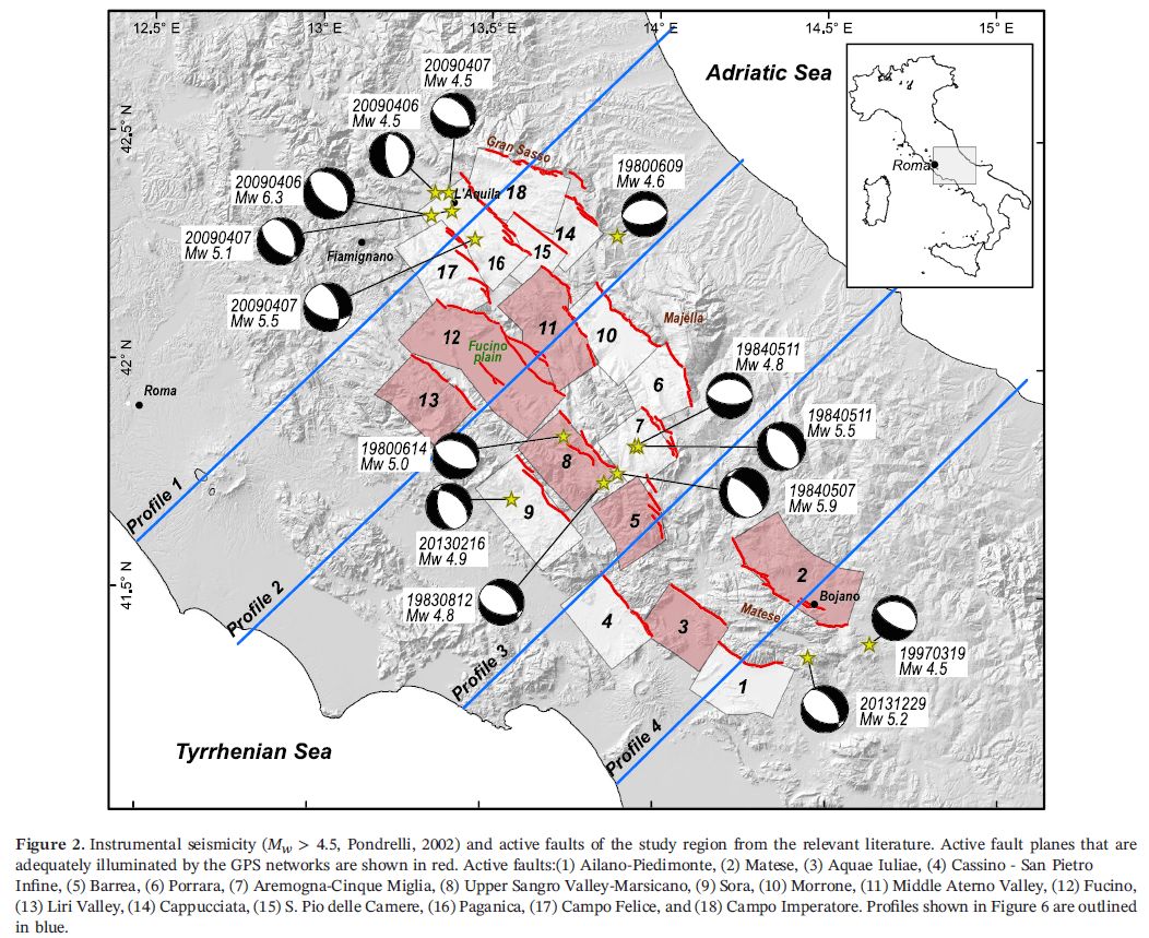
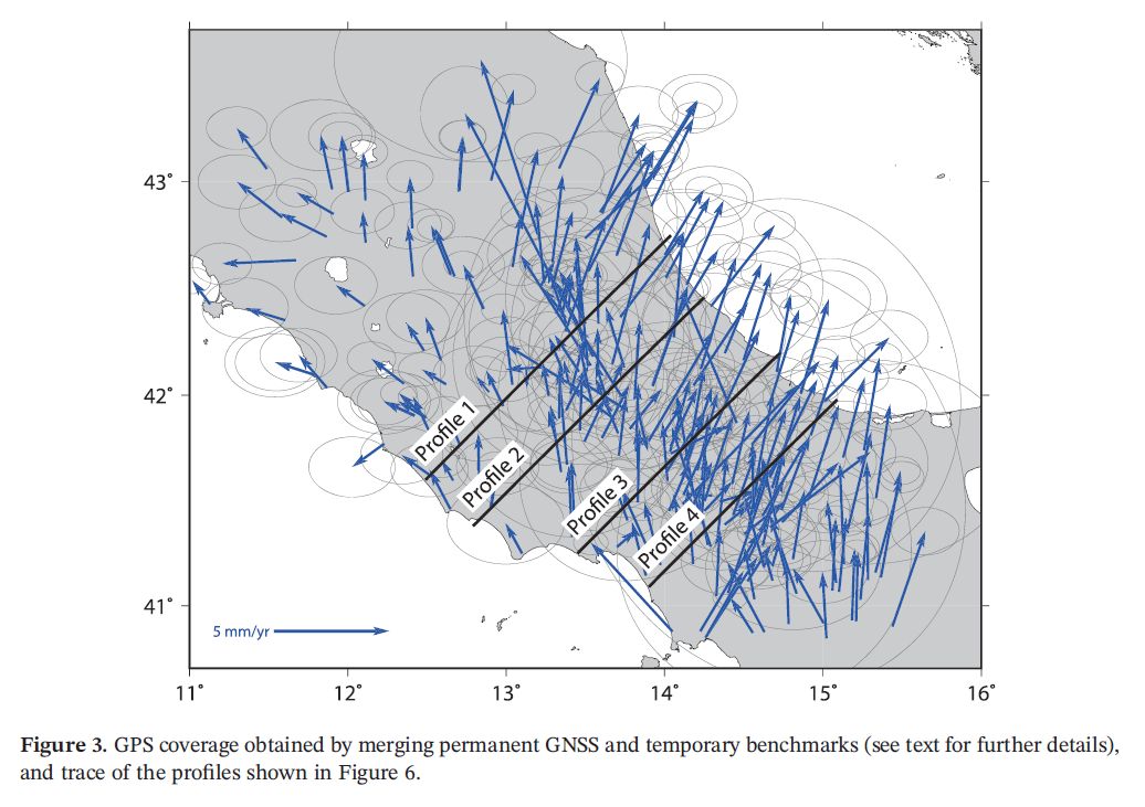
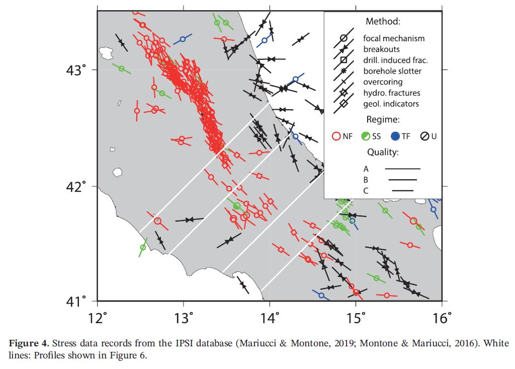
Abstract. We investigated whether the joint inversion of geodetic and stress direction data can constrain long‐term fault slip rates in the central Apennines, and ultimately how extension is partitioned among fault slip and bulk lithosphere permanent strain. Geodetic velocities are collected in the fault interseismic stage with steady secular deformation; thus, long‐term estimates can be derived with a model of elastically unloading seismogenic faults within a viscously deforming lithosphere. As the average spacing of permanent Global Navigation Satellite Systems (GNSS) stations is similar to the average length of seismogenic faults (25–35 km), if not larger, we decided to merge permanent and temporary GNSS measurements, resulting in a denser geodetic data set. Given that most normal faults in the Apennines have slip rates around or below 1 mm/a, and most campaign GNSS velocities carry similar uncertainties, simple local back-slip models cannot be applied. More sophisticated modeling is required to extract reasonable bulk deformation rates and long‐term fault slip rates at signal‐to‐noise ratio of order unity. Given the spatial distribution of the GNSS network, we estimated the long‐term slip rate of seven major fault systems that are in satisfactory agreement with available geological slip rates. The resulting spatial distribution of bulk deformation rates locally fits short‐term transients; in other cases, they represent the currently unclear signature of tectonic processes like upper‐crustal viscoplastic deformation and aseismic slip, or indicate missing faults in the adopted database. We conclude that the time is ripe for determining fault slip rates using geodetic and stress direction data, particularly where fault activity rates are hard to determine geologically
N.B. This paper demonstrates that neotectonic slip-rates of normal faults can be estimated from geodetic and stress-direction data alone, without the need for geologic slip-rates. This is one possible path to a seismic hazard model. However, our ultimate research goal is to also incorporate the geologic data (despite its complexities and associated controversies) for an even better model. Planned future publications will include statistical analysis of geologic slip-rate data from the Apennines, and then a joint neotectonic model in which these constraints are combined with geodetic and stress-direction constraints.