81. Shen, Z.-K., and P. Bird [2022] NeoKinema deformation model for the 2023 update to the U.S. National Seismic Hazard Model, Seismol. Res. Lett., 93(6), 3037-3052, doi: 10.1785/0220220179.
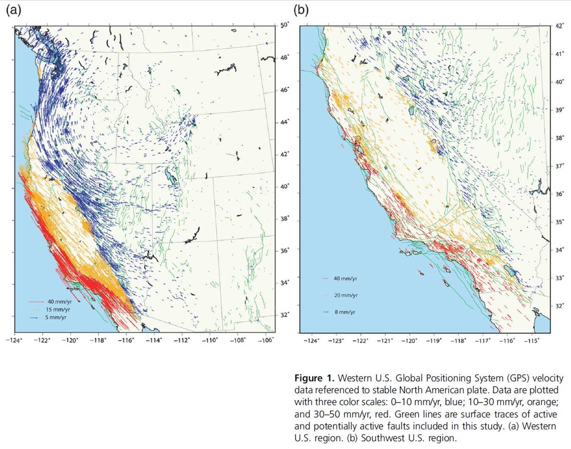
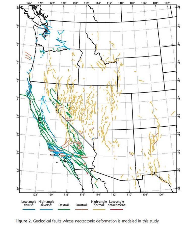
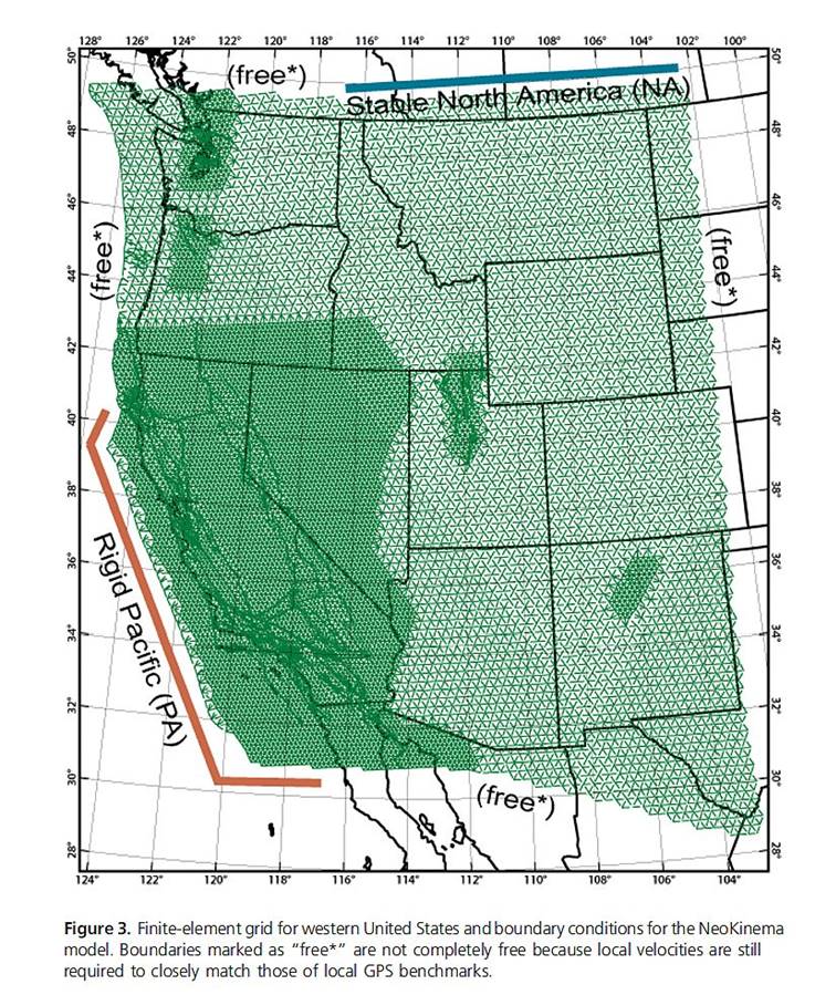
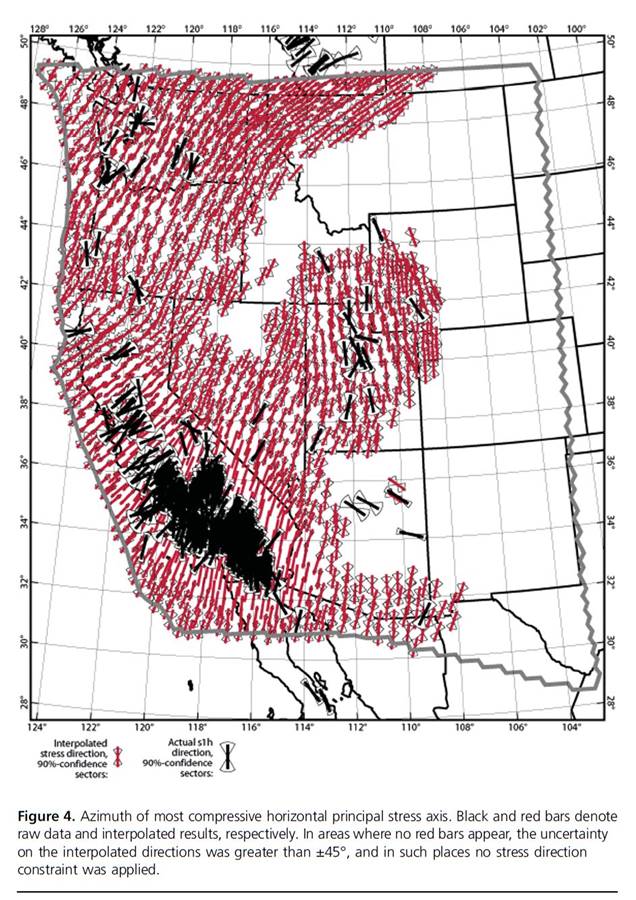
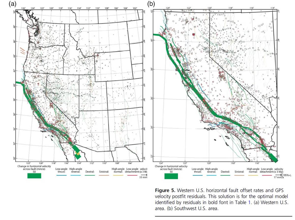
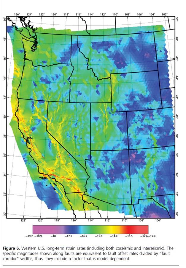
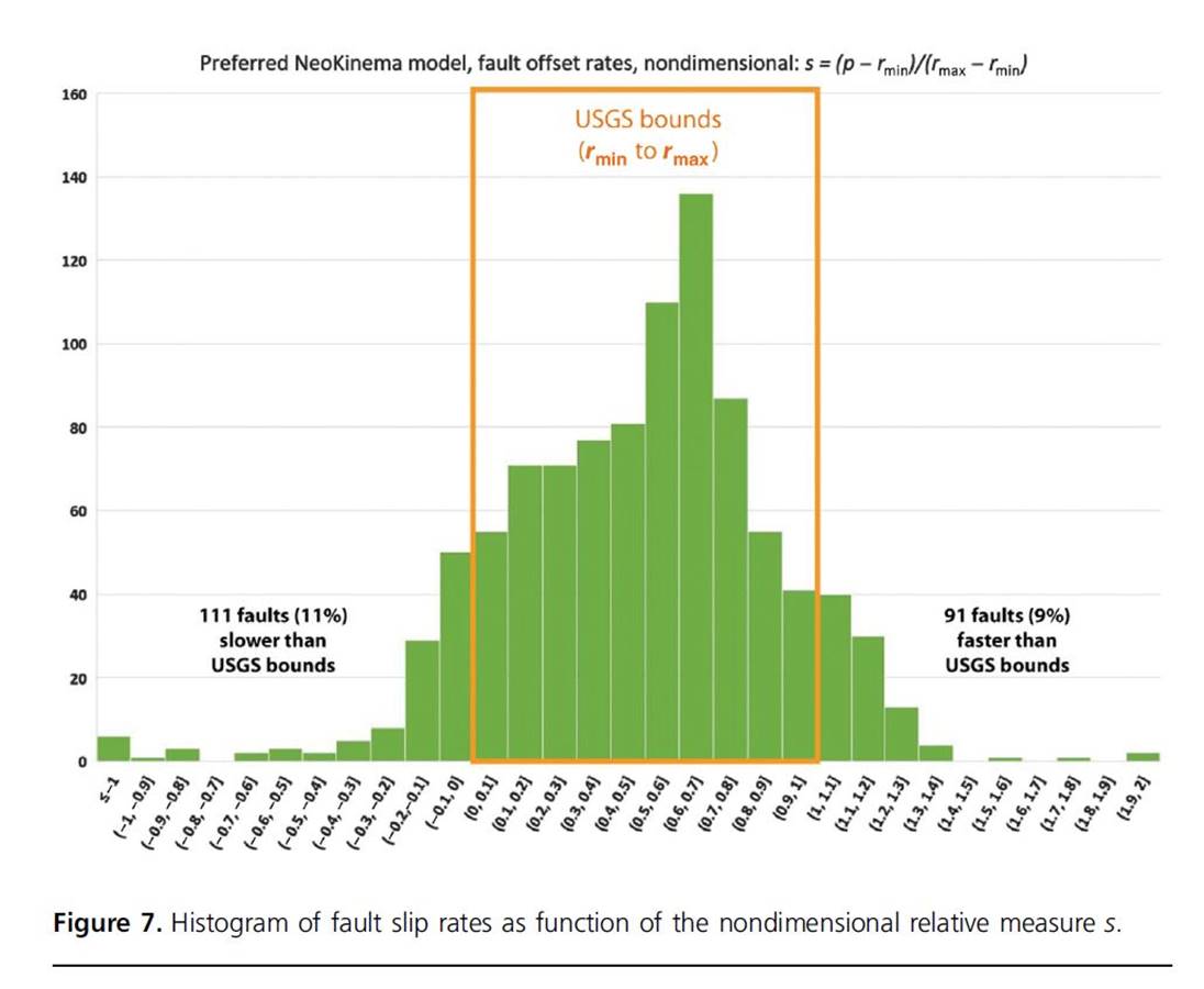
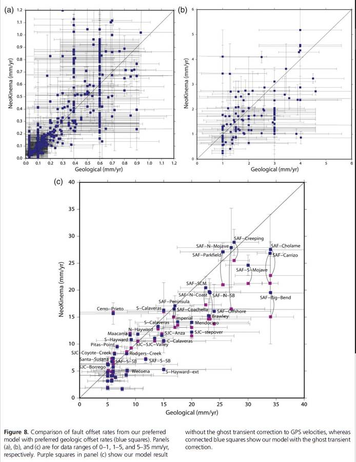
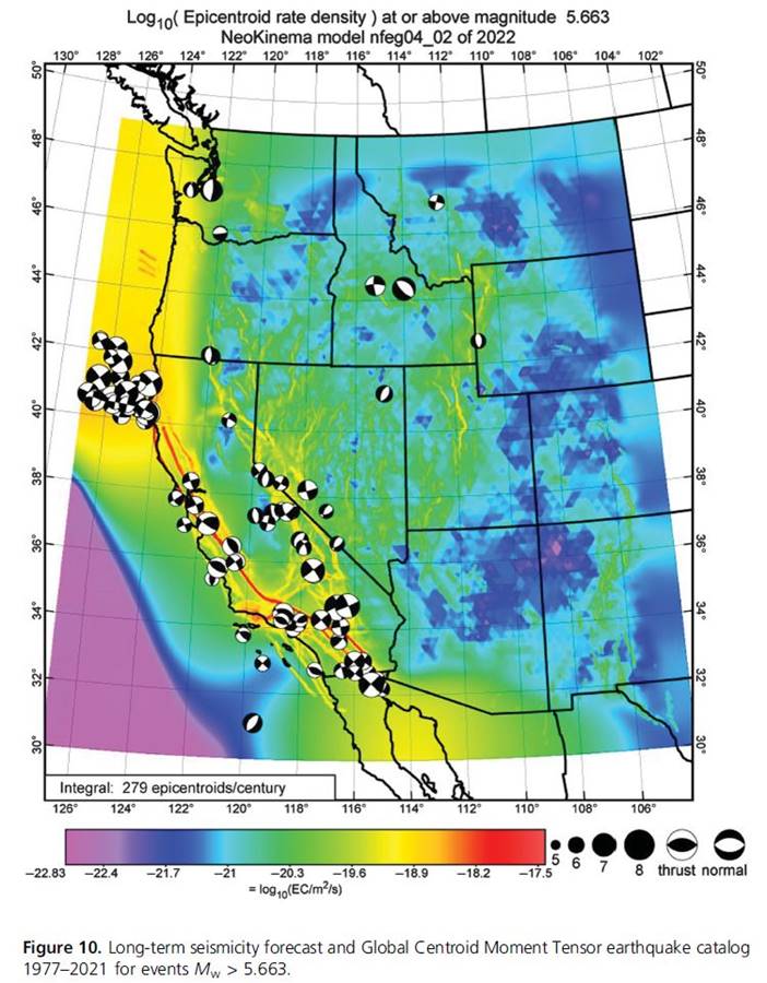
Abstract. We develop a crustal deformation model of the western conterminous United States for the 2023 update of the National Seismic Hazard Model (NSHM). The kinematic finite-element code NeoKinema is used to describe crustal deformation, including long-term slip on faults and off-fault strains (both elastic and permanent). Three different data sets—Global Positioning System (GPS) velocities, geological fault offset rates, and crustal stress orientations—are used to constrain the model, and the plate tectonic rotation of Pacific relative to North America is also imposed on some boundaries. Compared to the last NSHM model update in 2014, the GPS and geological fault data are substantially updated, and new corrections are implemented in both the data and modeling approach, including the correction of the “ghost transient” effect due to post-seismic deformation following large historic earthquakes, and correction for shallow creep on faults estimated from independent data. Based on these modeling results and a plate-tectonic model of the Cascadia subduction zone, a long-term seismicity rate map is also computed for the western United States; this map is independent of the local seismic catalog and can, therefore, be tested retrospectively as well as prospectively. We find good success in most of the region, except in Cascadia, where the 45-year instrumental seismicity record is much quieter than the forecast of our long-term model.
P.S. In the 2023 50-state Update to the National Seismic Hazard model published in January 2024 by USGS, this deformation model was assigned a weight of 32%. None of the other 4 models received a higher weight.