![]()
![]()
![]()
![]()
![]()
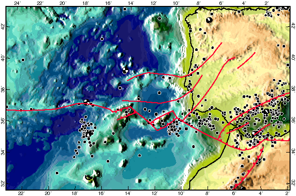
Step 1: Find or make a neotectonic map
A neotectonic map is a map showing active (and potentially-active) faults.
To make your own map, plot or photocopy the following to the same scale, and
then overlay:
topographic map, geologic map, seismicity map, and gravity map (preferably
isostatic or free-air anomaly).
On land, look for mapped faults which are also seismic, gravity, and/or
topographic lineaments.
At sea, look for lineaments in two or more of: topography, seismicity, and
gravity.
When in doubt, it is better to include too many faults than too few.
Also, connect faults under alluvial cover to form integrated systems.
Try to determine the dip direction for each fault.
Dip-slip faults usually have a consistently dipolar gravity anomaly;
strike-slip faults may have a gravity gradient of inconsistent sense, or none.