47. 47. Negredo, A. M., P. Bird, C. Sanz de Galdeano, and E. Buforn, Neotectonic modeling of the Ibero-Maghrebian region, J. Geophys. Res., 107(B11), 2292, doi:10.1029/2001JB000743, 2002.
Abstract. Thin-shell finite element techniques have been applied to model the neotectonics of the Ibero-Maghrebian region, in the westernmost Mediterranean. This region is characterized by a complex seismotectonic pattern and moderate seismic activity associated with the convergence between Africa and Eurasia. We compare two end-member models using different fault networks. Model predictions, including anelastic strain rates, vertically integrated stresses and velocity fields, are compared to the seismicity map and to data on directions of maximum horizontal compression. Best results are obtained assuming a low fault friction coefficient (0.05) and when the Betics and Rif are modeled as parts of the same arc-shaped chain. The highest predicted fault slip rates are in the Tell mountains. Farther to the west, fault slip is more homogeneously distributed over the Betic-Rif chain, Gulf of Cadiz, and Alboran Sea, indicating a diffuse geometry of the plate boundary in this area. The areas of highest predicted strain rates coincide with the most seismically active regions, located in northern Algeria and northeastern Morocco. Our best model also reproduces a major change of the stress regime, from thrusting in the east (Tell mountains) to predominantly strike-slip and normal faulting in the west (Betic-Rif chain and Alboran Sea). The Alboran basin is shown to be undergoing significant internal transpression and therefore cannot be considered as a rigid microplate. The western part of the Alboran Sea and surrounding areas are being extruded to the WNW with respect to Iberia.
Entire paper as a 1.18 MB .pdf (15 pages, black-and-white)
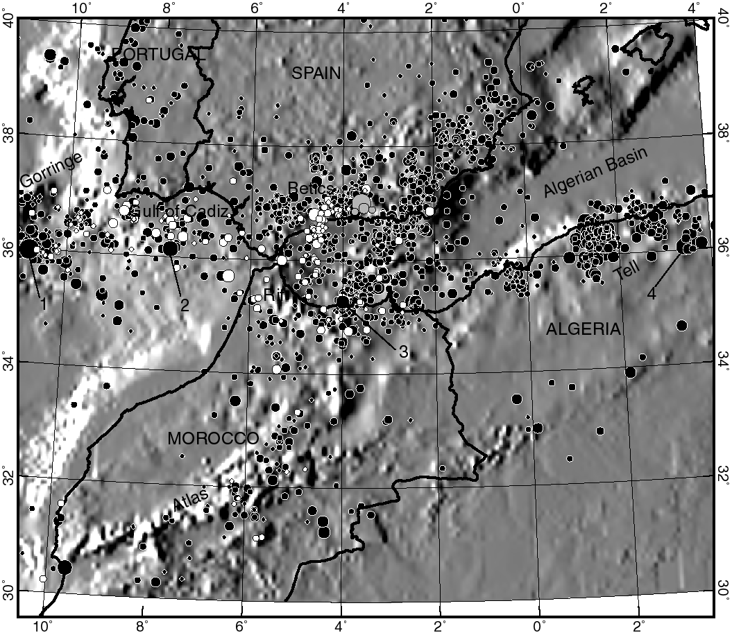
Figure 1. Topographic map (generated from the ETOPO5 data set) showing the seismicity distribution in the study area (Instituto Geográfico Nacional data file, 1910–1999, M 3.5). Solid, white, and gray circles represent shallow (h < 40 km), intermediate (40 < h < 130 km), and deep earthquakes (h > 130 km), respectively. The four earthquakes mentioned in the text are indicated with numbers 1 (28 February 1969, Ms = 7.8), 2 (15 March 1964, M = 6.2), 3 (26 May 1994, Mw = 5.8), and 4 (10 October 1980, Ms = 7.3). A geometric conic projection has been used, as in the rest of figures.
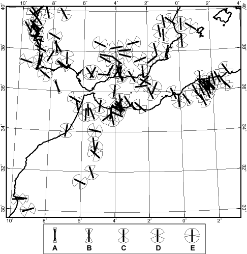
Figure 2. Directions and uncertainty ranges of the most compressive horizontal principal stress. The key associates A, B, C, D, E qualities with pie-wedge symbols of different sizes. Most data (63) come from the World Stress Map project [Zoback, 1992; Mueller et al., 2000], and 55 additional data come from published focal mechanism analyses of earthquakes of magnitude 4.0 or greater [e.g., Bezzeghoud and Buforn, 1999].
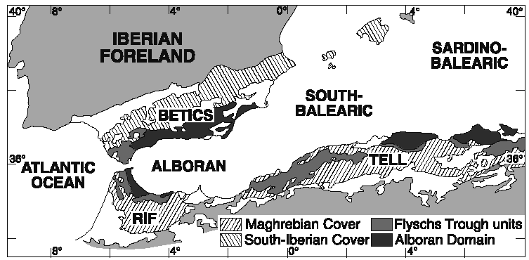
Figure 3. Simplified geologic map showing the main crustal domains of the Betic-Rif orogen and Tell mountains [from Comas et al., 1999].
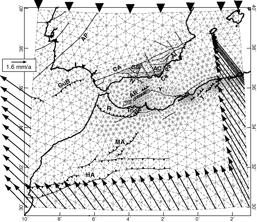
Figure 4. Finite element grid used for model set 1. Dashed and heavy lines represent continuum and fault elements, respectively. Different tick marks indicate assigned fault dip: triangle, 25º; straight, 65º; none, 90º. Names of fault zones are AC, Alpujarran corridor; Ca-Pa-Al, Alhama-Palomares-Carboneras; AP, Alentejo-Plasencia; AR, Alboran Ridge; CA, Cadiz-Alicante; GB, Granada Basin; GuB, Guadalquivir Bank; HA, High Atlas; N, Nerja; MA, Middle Atlas; Ne, Nekor; R, Rif; T, Tell; Tr, Trougout; Y, Yussuf. Velocity boundary conditions are shown with arrows: the northern boundary is fixed in the Eurasian reference frame, and the velocity of the Africa plate is applied to the southwestern, southeastern and southern boundaries.
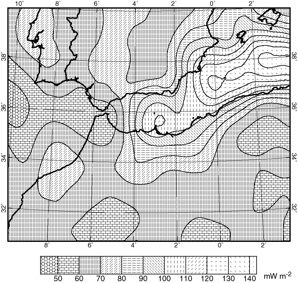
Figure 5. Surface heat flow distribution (see text for description of data sources) used to calculate lithosphere thickness. The most remarkable feature is the heat flow increase from the Gibraltar Arc to the Alboran Sea and Algerian basin.
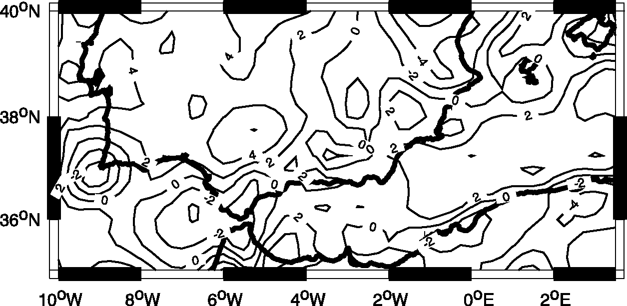
Figure 6. Distribution of discrepancies (in km) between crustal thickness derived from wide-angle seismic studies (see references in the text) and the values computed in this study.
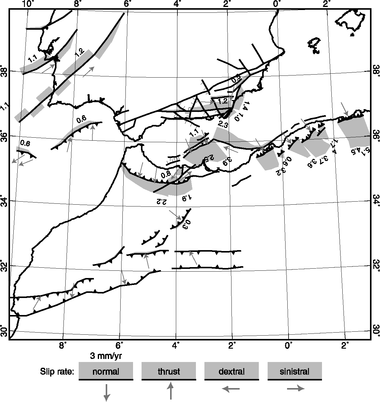
Figure 7. Fault slip rates (mm/yr) obtained with the fault network of model set 1 and a fault friction coefficient ff = 0.05 Small gray arrows in hanging walls show the directions of slip. Unlabeled faults have slip rates so low that they are probably numerical artifacts and should be considered as inactive.
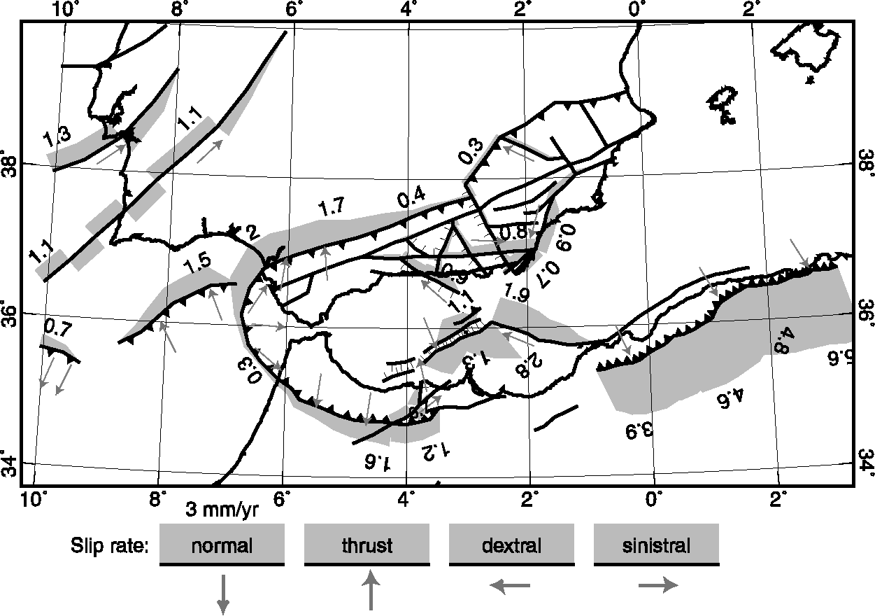
Figure 8. Fault slip rates obtained with our most successful model (model set 2, ff = 0.05). Conventions are as in Figure 7.
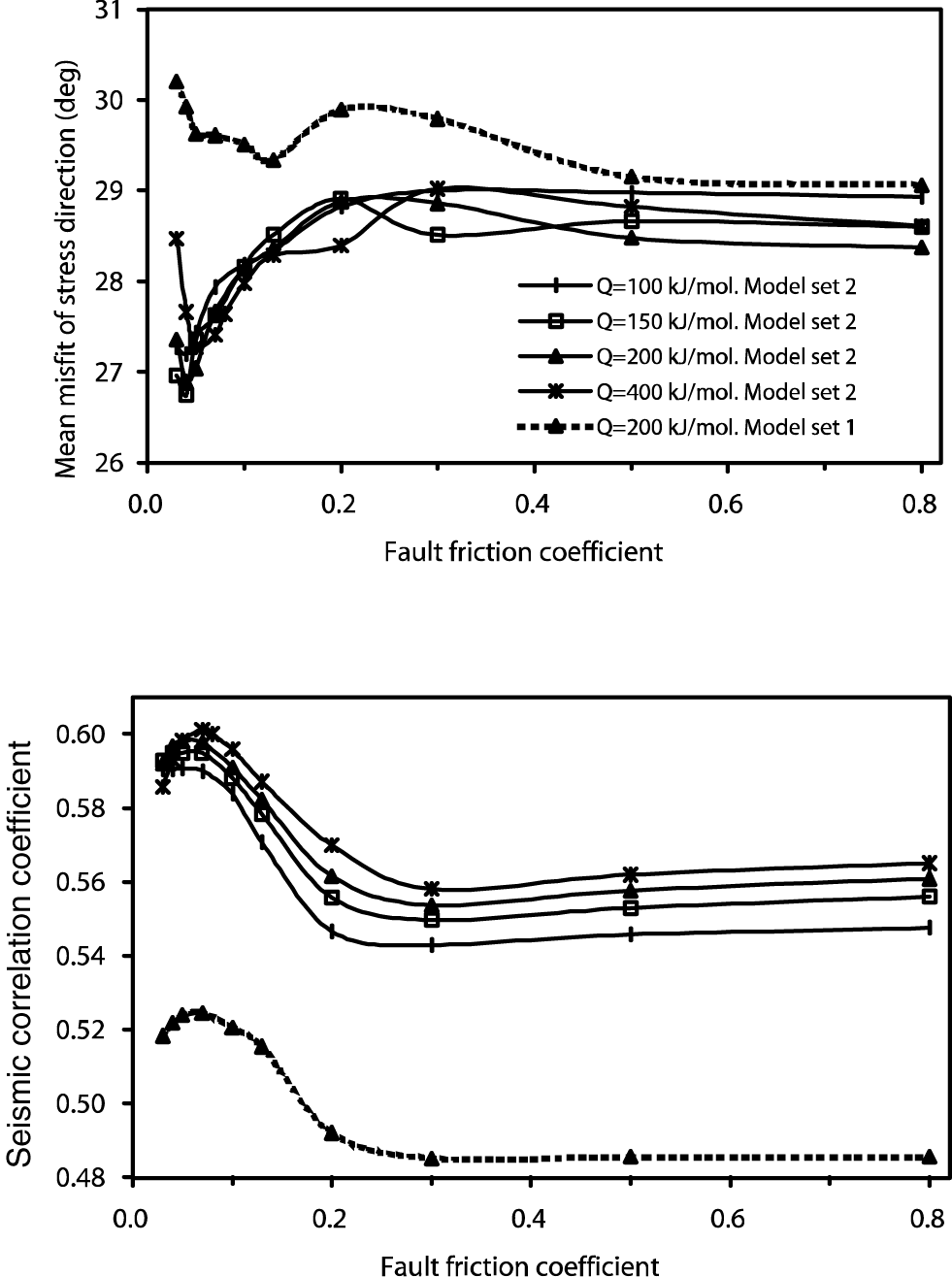
Figure 9. Results of testing two models based on different fault networks, against (top) seismicity distribution and (bottom) stress direction data. Best results are obtained with the fault network of model set 2 and a fault friction coefficient of 0.05.
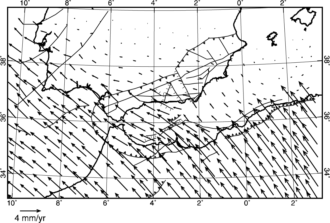
Figure 10. Predicted velocities (with respect to Europe) in the Ibero-Maghrebian region, from model set 2 with ff = 0.05. The reference point for each velocity vector is located at the tail. Some symbols have been omitted for clarity.
Figure 11. Common logarithms of smoothed strain rate (/s) predicted by model set 2 with ff = 0.05. To enable comparison with seismic strain rate, we also show the epicenters of shallow earthquakes of magnitude 5 or greater, in the period 1910–1999.
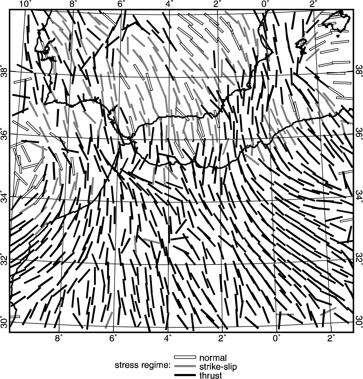
Figure 12. Most compressive horizontal principal stress orientations and stress regime predicted by the best model of model set 2 (with ff = 0.05). Some symbols have been omitted for clarity.