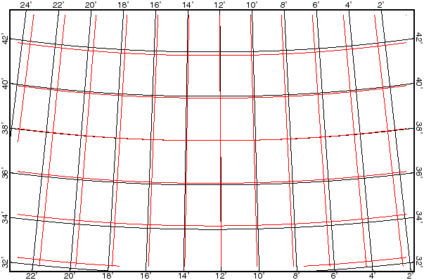
Step 6: Check your map-projection parameters
Load the .ai file(s) created by Projector into Adobe Illustrator to view and plot them. In particular, check whether your digitised parallels and meridians (red lines below) line up with those added automatically to each plot. If there is a problem, then you need to re-run Projector (re-do Step 5) and enter different parameters. To correct a scale-factor problem such as we see below, enter a different "Radius of the planet" when running Projector; if you change the "Map scale for new .ai plot", you will merely see the same error plotted with a different magnification! Sometimes small problems can also be fixed by applying a generalized linear transformation (magnify and/or shift) with my utility program Scale_DIG. If you have errors that cannot be fixed by a generalized linear transformation then this is a sign that you were mistaken about the projection type or projection point of the base map.
